


Experts call for stronger early warning systems amid rising disaster risks
Lalitpur: Water resources experts have called for stronger early warning systems, risk-sensitive development planning and greater cross-border coordination to reduce the growing impact of floods and other disasters in Nepal.

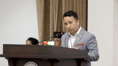
They made such a call at a seminar organized by Everest Engineering College in association with the Society of Hydrologists and Meteorologists-Nepal here on Tuesday.
In the seminar organized to discuss the causes and impacts of the August 26 Bhotekoshi floods and ways to reduce disaster risks, former Minister for Water Resources and water resources expert Deepak Gyawali argued that poorly planned development had increased people’s exposure to disasters.
He viewed that roads and settlements built along riverbanks had narrowed natural waterways, thereby increasing human and infrastructure losses during floods.
“Our misguided development practices are inviting disasters,” Gyawali observed, warning that climate change, rising temperatures and unstable geology were further increasing risks. He also suggested that hydropower projects should not be planned without proper disaster-risk assessments, noting that damage to major projects could have wider consequences for the country’s banking and insurance sectors.
Likewise, civil engineer and hydropower infrastructure expert Taranath Sapkota called for project designs based on at least 100 years of flood and natural-hazard data. He underscored the need for a long-term and resilient approach to infrastructure development, particularly in areas vulnerable to glacial lake outburst floods and other hazards.
Similarly, Tribhuvan University engineering geologist Prof Dr Ranjan Kumar Dahal highlighted the need for stronger cross-border disaster management and information-sharing mechanisms, particularly with China, noting that disasters can reach border areas within minutes.
Also speaking at the event, glacier and glacial-lake expert Prof Dr Rijhan Bhakta Kayastha recommended weekly analysis of satellite imagery to detect emerging risks. Kayastha also pointed out the need for a dedicated institution to assess satellite data and support rapid safety planning. According to him, Nepal has more than 3,800 glaciers and 2,374 glacial lakes.
Experts also univocally emphasized the need to make better use of satellite technology, improve preparedness and ensure that settlements and infrastructure do not obstruct natural river channels.
RSS




Comments